
Ficheiro:Ganymede-JupiterMoon-GeologicMap-SIM3237-20140211.png

Imagem numa resolução maior (5 801 × 4 099 píxeis, tamanho: 17,43 MB, tipo MIME: image/png)
|
|
Esta imagem provém do Wikimedia Commons, um acervo de conteúdo livre da Wikimedia Foundation que pode ser utilizado por outros projetos.
|
Descrição do ficheiro
| Descrição |
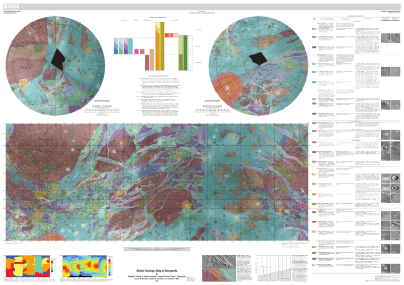
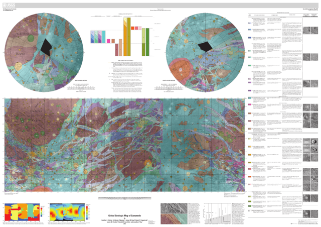
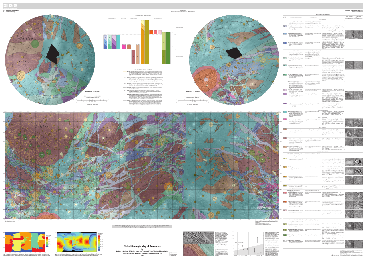
English: Global Geologic Map of Ganymede
http://pubs.usgs.gov/sim/3237/ By Geoffrey C. Collins, G. Wesley Patterson, James W. Head, Robert T. Pappalardo, Louise M. Prockter, Baerbel K. Lucchitta, and Jonathan P. Kay Thumbnail of and link to report PDF (22.5 MB) Summary Ganymede is the largest satellite of Jupiter, and its icy surface has been formed through a variety of impact cratering, tectonic, and possibly cryovolcanic processes. The history of Ganymede can be divided into three distinct phases: an early phase dominated by impact cratering and mixing of non-ice materials in the icy crust, a phase in the middle of its history marked by great tectonic upheaval, and a late quiescent phase characterized by a gradual drop in heat flow and further impact cratering. Images of Ganymede suitable for geologic mapping were collected during the flybys of Voyager 1 and Voyager 2 (1979), as well as during the Galileo Mission in orbit around Jupiter (1995–2003). This map represents a synthesis of our understanding of Ganymede geology after the conclusion of the Galileo Mission. We summarize the properties of the imaging dataset used to construct the map, previously published maps of Ganymede, our own mapping rationale, and the geologic history of Ganymede. Additional details on these topics, along with detailed descriptions of the type localities for the material units, may be found in the companion paper to this map (Patterson and others, 2010). UPLOADER NOTE (Drbogdan (talk) 20:32, 14 February 2014 (UTC)): Converted the original PDF file to a PNG File (via GIMP v2.8.4 program) - and uploaded to Wikimedia Commons. |
| Data | |
| Origem | http://pubs.usgs.gov/sim/3237/pdf/sim3237_mapsheet.pdf |
| Autor | USGS (United States Geological Survey) |
Licenciamento
Esta imagem está no domínio público porque ela contém materiais originalmente provenientes do Serviço Geológico dos Estados Unidos, uma agência do Departamento do Interior dos Estados Unidos. Para mais informações, veja a política oficial da USGS em relação a direitos autorais
|
Histórico do ficheiro
Clique uma data e hora para ver o ficheiro tal como ele se encontrava nessa altura.
| Data e hora | Miniatura | Dimensões | Utilizador | Comentário | |
|---|---|---|---|---|---|
| atual | 20h24min de 14 de fevereiro de 2014 | | 5 801 × 4 099 (17,43 MB) | Drbogdan | User created page with UploadWizard |
Utilização local do ficheiro
A seguinte página usa este ficheiro:
Utilização global do ficheiro
As seguintes wikis usam este ficheiro:
- af.wikipedia.org
- ast.wikipedia.org
- ba.wikipedia.org
- en.wikipedia.org
- en.wikiversity.org
- fr.wikipedia.org
- hy.wikipedia.org
- ja.wikipedia.org
- ko.wikipedia.org
- ro.wikipedia.org
- ru.wikipedia.org
- uk.wikipedia.org