
Ficheiro:GeorgeVLandstubmap.jpg
Sem resolução maior disponível.
GeorgeVLandstubmap.jpg (300 × 334 píxeis, tamanho: 43 kB, tipo MIME: image/jpeg)
|
|
Esta imagem provém do Wikimedia Commons, um acervo de conteúdo livre da Wikimedia Foundation que pode ser utilizado por outros projetos.
|
Descrição do ficheiro
| Descrição |
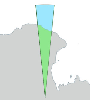
English: Outline map of George V Land, Antarctica. |
| Data | |
| Origem |
Este ficheiro foi derivado de: Antarctica, territorial claims.svg |
| Autor | Lokal_Profil, DooFi Grutness |

|
Esta imagem de mapas (ou todas as imagens neste artigo ou categoria) deveriam ser recriadas usando gráficos vectoriais, como ficheiros SVG. Isto tem várias vantagens; veja as Commons:Media for cleanup|imagens para rever para mais informações. Se já criou um ficheiro SVG desta imagem, por favor, carregue-o. Depois do novo ficheiro SVG ter sido carregado, substitua aqui esta predefinição pela predefinição {{vector version available|nome da nova imagem.svg}}.
|


Licenciamento
A utilização deste ficheiro é regulada nos termos da licença Creative Commons - Atribuição-CompartilhaIgual 2.5 Genérica.
- Pode:
- partilhar – copiar, distribuir e transmitir a obra
- recombinar – criar obras derivadas
- De acordo com as seguintes condições:
- atribuição – Tem de fazer a devida atribuição da autoria, fornecer uma hiperligação para a licença e indicar se foram feitas alterações. Pode fazê-lo de qualquer forma razoável, mas não de forma a sugerir que o licenciador o apoia ou subscreve o seu uso da obra.
- partilha nos termos da mesma licença – Se remisturar, transformar ou ampliar o conteúdo, tem de distribuir as suas contribuições com a mesma licença ou uma licença compatível com a original.
Registo de carregamento original
A página de descrição original está aqui. Todos os nomes de utilizador a seguir referem-se a en.wikipedia.
| Data e hora | Dimensões | Utilizador | Comentário |
|---|---|---|---|
| 2011-07-07 10:47 | 300×334× (43572 bytes) | Grutness | Outline map of George V Land, Antarctica. Generated from [[:File:Antarctica,_territorial_claims.svg]] ({{cc-by-sa-2.5|[[:User:Lokal_Profil|Lokal_Profil]]}}) by myself ([[User:Grutness]]) |
Histórico do ficheiro
Clique uma data e hora para ver o ficheiro tal como ele se encontrava nessa altura.
| Data e hora | Miniatura | Dimensões | Utilizador | Comentário | |
|---|---|---|---|---|---|
| atual | 17h42min de 7 de dezembro de 2018 | | 300 × 334 (43 kB) | YuriNikolai | Transferred from en.wikipedia via #commonshelper |
Utilização local do ficheiro
As seguintes 2 páginas usam este ficheiro:
Utilização global do ficheiro
As seguintes wikis usam este ficheiro:
- en.wikipedia.org
- Point Alden
- Commonwealth Bay
- Fletcher Islands
- Fletcher Island
- Ninnis Glacier
- Fisher Bay
- Buckley Bay (Antarctica)
- Cape Freshfield
- Cook Ice Shelf
- George V Coast
- Mawson Peninsula
- George V Land
- Zélée Subglacial Trench
- Aurora Peak
- Ainsworth Bay, Antarctica
- Wilkes Basin
- Cape Bage
- Blair Islands
- Cape-Pigeon Rocks
- Close Islands
- Organ Pipe Cliffs
- Watt Bay
- Way Archipelago
- Webb Subglacial Trench
- Cape Webb
- Whetter Nunatak
- Correll Nunatak
- Cape De la Motte
- Deakin Bay
- Cape Wild
- Stillwell Island
- Murphy Bay
- Dixson Island
- Doolette Bay
- Douanier Rock
- Cape Pollock
- Garnet Point
- Cape Gray
- Greater Mackellar Island
- Moyes Islands
- Hannam Islands
- McLean Nunataks
- Hodgeman Islands
- Mount Hunt (Antarctica)
- Cape Hunter
- Cape Hurley
- Mackellar Islands
- Madigan Nunatak
- Southern Cross Subglacial Highlands
- Horn Bluff
Ver mais utilizações globais deste ficheiro.