
Ficheiro:GrahamLandstubmap.png
Sem resolução maior disponível.
GrahamLandstubmap.png (243 × 334 píxeis, tamanho: 30 kB, tipo MIME: image/png)
|
|
Esta imagem provém do Wikimedia Commons, um acervo de conteúdo livre da Wikimedia Foundation que pode ser utilizado por outros projetos.
|
Descrição do ficheiro
| Descrição |
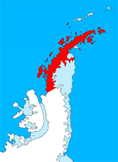
English: Outline map of the Antarctic Peninsula showing Graham Land.
Drawn by me (User:Grutness) based on File:Ant-pen_map.png by Giovanni Fattori. |
| Data | 2 de julho de 2011 (data de carregamento original) |
| Origem | Transferido de en.wikipedia para a wiki Commons. |
| Autor | Este ficheiro foi inicialmente carregado por Grutness em Wikipédia em inglês |
Licenciamento

|
É concedida permissão para copiar, distribuir e/ou modificar este documento nos termos da Licença de Documentação Livre GNU, versão 1.2 ou qualquer versão posterior publicada pela Free Software Foundation; sem Secções Invariantes, sem textos de Capa e sem textos de Contra-Capa. É incluída uma cópia da licença na secção intitulada GNU Free Documentation License. |
Registo de carregamento original
A página de descrição original está aqui. Todos os nomes de utilizador a seguir referem-se a en.wikipedia.
- 2011-07-02 09:38 Grutness 243×334× (30925 bytes) Outline map of the Antarctic Peninsula showing [[Graham Land]]. Drawn by me (User:Grutness) based on [[:File:Ant-pen_map.png]] by Giovanni Fattori.{{GFDL}}
Histórico do ficheiro
Clique uma data e hora para ver o ficheiro tal como ele se encontrava nessa altura.
| Data e hora | Miniatura | Dimensões | Utilizador | Comentário | |
|---|---|---|---|---|---|
| atual | 20h06min de 9 de julho de 2011 | | 243 × 334 (30 kB) | MGA73bot2 | {{BotMoveToCommons|en.wikipedia|year={{subst:CURRENTYEAR}}|month={{subst:CURRENTMONTHNAME}}|day={{subst:CURRENTDAY}}}} {{Information |Description={{en|Outline map of the Antarctic Peninsula showing en:Graham Land. Drawn by me (User:Grutness) base |
Utilização local do ficheiro
As seguintes 15 páginas usam este ficheiro:
Utilização global do ficheiro
As seguintes wikis usam este ficheiro:
- az.wikipedia.org
- bg.wikipedia.org
- cs.wikipedia.org
- da.wikipedia.org
- de.wikipedia.org
- en.wikipedia.org
- Mount Scott (Antarctica)
- Bowman Coast
- Cuverville Island
- Danco Island
- Charlotte Bay
- Loubet Coast
- Mill Inlet
- Cabinet Inlet
- Cape Alexander
- Cole Peninsula
- Castle Peak (Antarctica)
- Quartermain Glacier
- Quervain Peak
- Aagaard Glacier
- Bigourdan Fjord
- Cape Jeremy
- Weertman Island
- Bennett Islands
- Liard Island
- Devil Island
- Upper Island
- Useful Island
- Mount Zdarsky
- Mount Shackleton
- Shag Rock (Antarctica)
- Shanty Point
- Sharp Glacier
- Mount Shelby
- Mount St. Louis
- Shull Rocks
- Simler Snowfield
- Zilva Peaks
- Saffery Islands
- Index Peak
- Foyn Point
- Haefeli Glacier
- Finsterwalder Glacier
- Azufre Point
Ver mais utilizações globais deste ficheiro.