
Ficheiro:Gulf of Finland NLT Landsat7.png

Dimensões desta antevisão: 800 × 371 píxeis. Outras resoluções: 320 × 148 píxeis | 640 × 297 píxeis | 1 024 × 475 píxeis | 1 280 × 593 píxeis | 2 500 × 1 159 píxeis.
Imagem numa resolução maior (2 500 × 1 159 píxeis, tamanho: 4,79 MB, tipo MIME: image/png)
|
|
Esta imagem provém do Wikimedia Commons, um acervo de conteúdo livre da Wikimedia Foundation que pode ser utilizado por outros projetos.
|
Descrição do ficheiro
| Descrição |
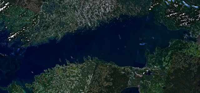
English: Visible colour satellite image of Gulf of Finland.
Русский: Финский залив.
Suomi: Suomenlahti.
Eesti: Soome laht.
Svenska: Finska viken.
Deutsch: Finnische Meerbusen. |
| Data | 16 de abril de 2006 (data do carregamento) |
| Origem | Satellite imagery taken from NASA World Wind software (by screenshot), NLT Landsat7 layer. |
| Autor | NASA |
Licenciamento
| This image is in the public domain because it is a screenshot from NASA’s globe software World Wind using a public domain layer, such as Blue Marble, MODIS, Landsat, SRTM, USGS or GLOBE.
|
 |
Histórico do ficheiro
Clique uma data e hora para ver o ficheiro tal como ele se encontrava nessa altura.
| Data e hora | Miniatura | Dimensões | Utilizador | Comentário | |
|---|---|---|---|---|---|
| atual | 16h41min de 18 de abril de 2006 | | 2 500 × 1 159 (4,79 MB) | Hautala | {{PD-WorldWind}} Visible colour satellite image of Gulf of Finland. Screenshot of NASA World Wind, NLT Landsat7 layer. Category:Satellite photos |
Utilização local do ficheiro
A seguinte página usa este ficheiro:
Utilização global do ficheiro
As seguintes wikis usam este ficheiro:
- ar.wikipedia.org
- arz.wikipedia.org
- ast.wikipedia.org
- ba.wikipedia.org
- be-tarask.wikipedia.org
- br.wikipedia.org
- ca.wikipedia.org
- cy.wikipedia.org
- da.wikipedia.org
- eo.wikipedia.org
- fy.wikipedia.org
- ga.wikipedia.org
- he.wikipedia.org
- hy.wikipedia.org
- ms.wikipedia.org
- mzn.wikipedia.org
- no.wikipedia.org
- pnb.wikipedia.org
- ro.wikipedia.org
- ru.wikinews.org
- www.wikidata.org