
Ficheiro:Map of South Africa with Tshwane highlighted (2011).svg

Dimensões desta antevisão em PNG do ficheiro SVG: 684 × 599 píxeis Outras resoluções: 274 × 240 píxeis | 548 × 480 píxeis | 876 × 768 píxeis | 1 168 × 1 024 píxeis | 2 337 × 2 048 píxeis | 809 × 709 píxeis.
Imagem numa resolução maior (ficheiro SVG, de 809 × 709 píxeis, tamanho: 467 kB)
|
|
Esta imagem provém do Wikimedia Commons, um acervo de conteúdo livre da Wikimedia Foundation que pode ser utilizado por outros projetos.
|
.svg)
Descrição do ficheiro
| Descrição |
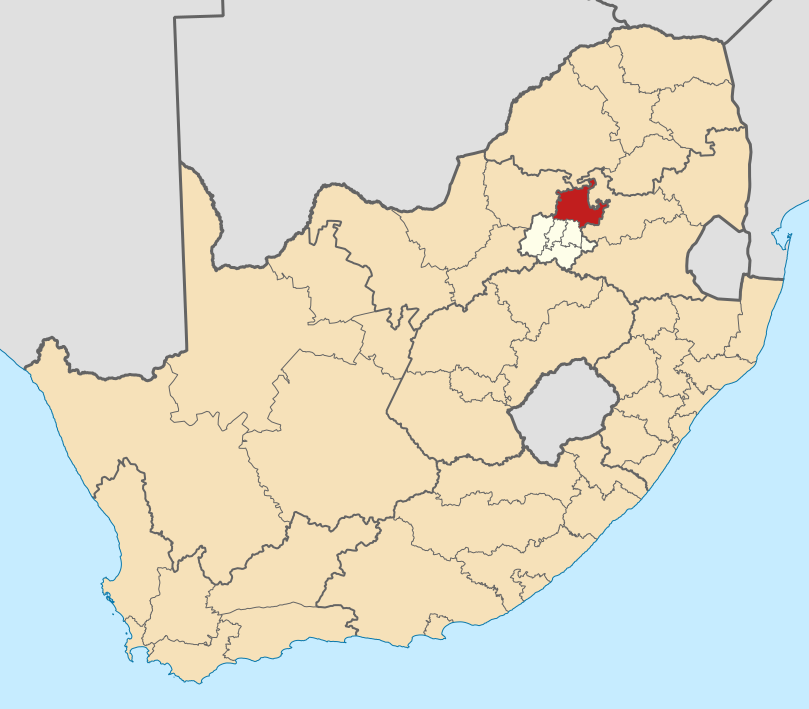
English: Map of district boundaries in South Africa, as they will be after the municipal elections of 18 May 2011, with the City of Tshwane Metropolitan Municipality highlighted in red within Gauteng in yellow. |
| Data | |
| Origem | Obra do próprio |
| Autor | Htonl |
Licenciamento
Eu, titular dos direitos de autor desta obra, publico-a com as seguintes licenças:

|
É concedida permissão para copiar, distribuir e/ou modificar este documento nos termos da Licença de Documentação Livre GNU, versão 1.2 ou qualquer versão posterior publicada pela Free Software Foundation; sem Secções Invariantes, sem textos de Capa e sem textos de Contra-Capa. É incluída uma cópia da licença na secção intitulada GNU Free Documentation License. |
This file is licensed under the Creative Commons Attribution-Share Alike Attribution-Share Alike 4.0 International, 3.0 Unported, 2.5 Generic, 2.0 Generic and 1.0 Generic license.
- Pode:
- partilhar – copiar, distribuir e transmitir a obra
- recombinar – criar obras derivadas
- De acordo com as seguintes condições:
- atribuição – Tem de fazer a devida atribuição da autoria, fornecer uma hiperligação para a licença e indicar se foram feitas alterações. Pode fazê-lo de qualquer forma razoável, mas não de forma a sugerir que o licenciador o apoia ou subscreve o seu uso da obra.
- partilha nos termos da mesma licença – Se remisturar, transformar ou ampliar o conteúdo, tem de distribuir as suas contribuições com a mesma licença ou uma licença compatível com a original.
Pode escolher a licença que quiser.
Histórico do ficheiro
Clique uma data e hora para ver o ficheiro tal como ele se encontrava nessa altura.
| Data e hora | Miniatura | Dimensões | Utilizador | Comentário | |
|---|---|---|---|---|---|
| atual | 20h19min de 2 de maio de 2011 | | 809 × 709 (467 kB) | Htonl | == Summary == {{Information |Description ={{en|1=Map of district boundaries in South Africa, as they will be after the municipal elections of 18 May 2011, with the [[w:City of Tshwane Metropolitan Municipali |
Utilização local do ficheiro
A seguinte página usa este ficheiro:
Utilização global do ficheiro
As seguintes wikis usam este ficheiro:
- af.wikipedia.org
- Pretoria
- Centurion
- Cullinan
- Marabastad
- Brooklyn, Pretoria
- Waterkloof
- Groenkloof
- Hatfield, Pretoria
- Arcadia, Pretoria
- Elarduspark
- Irene
- Bronkhorstspruit
- Valhalla
- Kleinfontein
- Mabopane
- Atteridgeville
- Capital Park
- Hammanskraal
- Rayton
- Die Wilgers
- Winterveld
- Rietfontein, Pretoria
- Highveld
- Erasmuskloof
- Wingate Park
- Pierre van Ryneveldpark
- Moreletapark
- Monument Park
- Waterkloofrif
- Menlopark, Pretoria
- Kloofsig
- Lyttelton
- Constantiapark
- Lynnwood
- Olievenhoutbosch
- Ga-Rankuwa
- Mamelodi
- Soshanguve
- Akasia
- Temba
- Chantelle
- Orchards, Pretoria
- Pretoria-Noord
- Rosslyn
- Laudium
- Lyttelton Manor
- Doringkloof
- Villieria
- Waverley
- Garsfontein
Ver mais utilizações globais deste ficheiro.
.svg)
.svg)