
Ficheiro:Map of USA AK full.png
Sem resolução maior disponível.
Map_of_USA_AK_full.png (284 × 184 píxeis, tamanho: 19 kB, tipo MIME: image/png)
|
|
Esta imagem provém do Wikimedia Commons, um acervo de conteúdo livre da Wikimedia Foundation que pode ser utilizado por outros projetos.
|

|
File:Map of USA AK full.svg é uma versão vetorial deste ficheiro. Ela deve ser usada em vez desta imagem em formato raster, se não for de qualidade inferior.
File:Map of USA AK full.png → File:Map of USA AK full.svg
Para mais informações, consulte Ajuda:SVG. |
 |
Descrição do ficheiro
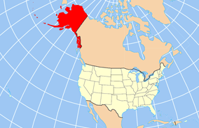
| Descrição | Map of USA with Alaska highlighted and shown in true position |
| Data | |
| Origem | http://www.nationalatlas.gov/printable/reference.html |
| Autor | |
| Outras versões | File:Map of USA AK full.svg |
Licenciamento
This map was obtained from an edition of the National Atlas of the United States. Like almost all works of the U.S. federal government, works from the National Atlas are in the public domain in the United States.
Online access: NationalAtlas.gov | 1970 print edition: Library of Congress, Perry-Castañeda Library
|
Histórico do ficheiro
Clique uma data e hora para ver o ficheiro tal como ele se encontrava nessa altura.
| Data e hora | Miniatura | Dimensões | Utilizador | Comentário | |
|---|---|---|---|---|---|
| atual | 20h43min de 17 de dezembro de 2012 | | 284 × 184 (19 kB) | Ras67 | cropped |
| 16h31min de 2 de abril de 2007 |  | 286 × 186 (20 kB) | MattWright | fix to more standard map colors | |
| 06h20min de 2 de abril de 2007 |  | 286 × 186 (19 kB) | MattWright | {{Information |Description=Map of USA with Alaska highlighted and shown in true position |Source=http://www.nationalatlas.gov/printable/reference.html |Date=2007-04-02 |Author= |Permission= |other_versions= }} Category:Maps of the United States [[Cat |
Utilização local do ficheiro
A seguinte página usa este ficheiro:
Utilização global do ficheiro
As seguintes wikis usam este ficheiro:
- am.wikipedia.org
- ar.wikipedia.org
- az.wikipedia.org
- az.wiktionary.org
- ba.wikipedia.org
- bn.wikipedia.org
- ce.wikipedia.org
- cy.wikipedia.org
- da.wikipedia.org
- de.wikipedia.org
- el.wikipedia.org
- en.wikipedia.org
- es.wikibooks.org
- fa.wikipedia.org
- fr.wikinews.org
- ga.wikipedia.org
- Sitka
- Buirg Aleutians Thoir, Alasca
- Buirg Anchorage, Alasca
- Buirg Artach Thiar Thuaidh, Alasca
- Buirg Bristol Bay, Alasca
- Buirg Denali, Alasca
- Buirg Fairbanks Réalta Thuaidh, Alasca
- Buirg Haines, Alasca
- Buirg Juneau, Alasca
- Buirg Leithinis Kenai, Alasca
- Buirg Tairseach Ketchikan, Alasca
- Buirg Oileán Kodiak, Alasca
- Buirg Loch agus Leithinis, Alasca
- Buirg Matanuska-Susitna, Alasca
Ver mais utilizações globais deste ficheiro.