
Ficheiro:Morgan City Louisiana aerial view.jpg

Dimensões desta antevisão: 800 × 533 píxeis. Outras resoluções: 320 × 213 píxeis | 640 × 427 píxeis | 1 024 × 683 píxeis | 1 500 × 1 000 píxeis.
Imagem numa resolução maior (1 500 × 1 000 píxeis, tamanho: 622 kB, tipo MIME: image/jpeg)
|
|
Esta imagem provém do Wikimedia Commons, um acervo de conteúdo livre da Wikimedia Foundation que pode ser utilizado por outros projetos.
|
| Descrição |
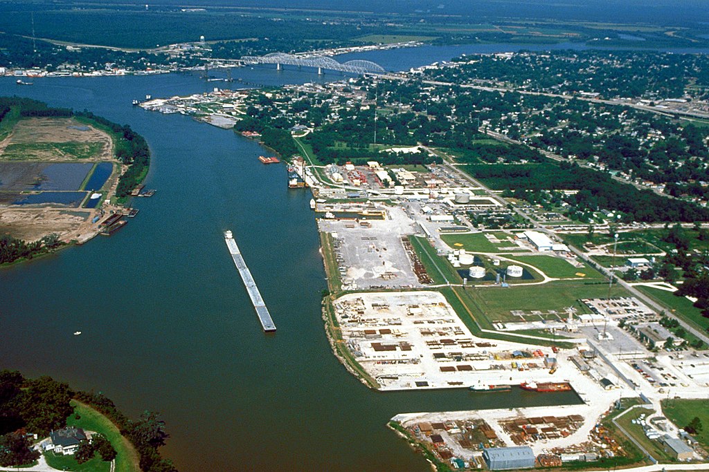
English: Aerial view of the port of Morgan City, Louisiana, USA. The Atchafalaya River flows from right to left in the background. These waterways are part of the Gulf Intracoastal Waterway. View is to the west. |
|||
| Data | ||||
| Origem |
U.S. Army Corps of Engineers Digital Visual Library Image page Image description page Digital Visual Library home page |
|||
| Autor | Arthur Belala, U.S. Army Corps of Engineers | |||
| Permissão (Reutilizar este ficheiro) |
|
|||
| Local | Morgan City, Louisiana, USA |
| Localização da câmara | | Esta e outras imagens nas suas localizações em: OpenStreetMap |
|---|
Histórico do ficheiro
Clique uma data e hora para ver o ficheiro tal como ele se encontrava nessa altura.
| Data e hora | Miniatura | Dimensões | Utilizador | Comentário | |
|---|---|---|---|---|---|
| atual | 05h43min de 1 de abril de 2007 | | 1 500 × 1 000 (622 kB) | DanMS | {{Information | Description = {{en|Aerial view of the port of Morgan City, Louisiana, USA. The Atchafalaya River flows from right to left in the background. These waterways are part of the Gulf Intracoastal Waterway.}} | Source = U.S. Army Corp |
Utilização local do ficheiro
A seguinte página usa este ficheiro:
Utilização global do ficheiro
As seguintes wikis usam este ficheiro:
- azb.wikipedia.org
- ceb.wikipedia.org
- de.wikipedia.org
- fa.wikipedia.org
- fi.wikipedia.org
- fr.wikipedia.org
- it.wikipedia.org
- nl.wikipedia.org
- pl.wikipedia.org
- sh.wikipedia.org
- sr.wikipedia.org
- tr.wikipedia.org
- uk.wikipedia.org
- zh-min-nan.wikipedia.org