
Ficheiro:Nye fylker - regjeringen.no.svg

Imagem numa resolução maior (ficheiro SVG, de 515 × 689 píxeis, tamanho: 85 kB)
|
|
Esta imagem provém do Wikimedia Commons, um acervo de conteúdo livre da Wikimedia Foundation que pode ser utilizado por outros projetos.
|
Descrição do ficheiro
| Descrição |
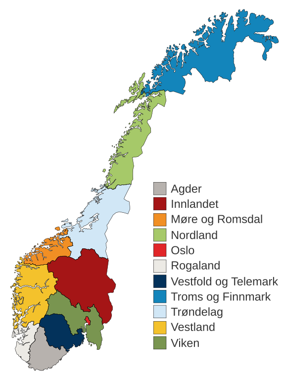
English: Municipal and regional reform: "On 8 June 2017, the Storting decided the following merger of counties". Illustration included.
Norsk bokmål: Kommune- og regionreform: "Stortinget vedtok 8. juni 2017 følgende sammenslåinger av fylker". Medfølgende kart-illustrasjon. |
|||
| Data | ||||
| Origem |
Este ficheiro foi derivado de: Fylkeskart-regionreform.jpg |
|||
| Autor | Furfur | |||
| Permissão (Reutilizar este ficheiro) |
|
|||
| Outras versões |
|
|||
| SVG desenvolvimento | O código-fonte desta imagem SVG é válido. Esta carta geográfica foi criada com o Adobe Illustrator Esta carta geográfica SVG utiliza texto incorporado que pode ser facilmente traduzido usando um editor de texto. |


Histórico do ficheiro
Clique uma data e hora para ver o ficheiro tal como ele se encontrava nessa altura.
| Data e hora | Miniatura | Dimensões | Utilizador | Comentário | |
|---|---|---|---|---|---|
| atual | 01h54min de 3 de janeiro de 2020 | | 515 × 689 (85 kB) | Furfur | Korr. |
| 01h42min de 3 de janeiro de 2020 |  | 515 × 689 (85 kB) | Furfur | == {{int:filedesc}} == {{Information |Description={{User:Medium69/Traduction}} {{no|1=Kommune- og regionreform: "Stortinget vedtok 8. juni 2017 følgende sammenslåinger av fylker". Medfølgende kart-illustrasjon. }} |Source={{Derived from|Fylkeskart-regionreform.jpg}} *[https://www.regjeringen.no/no/tema/kommuner-og-regioner/regionreform/regionreform/nye-fylker/id2548426/ Nye fylker] |Date=2020-01-03 |Author={{U|Furfur}} |Permission={{self|GFDL|cc-by-sa-4.0}} |Other versions={{bva|Fylkeskart-re... |
Utilização local do ficheiro
As seguintes 3 páginas usam este ficheiro:
Utilização global do ficheiro
As seguintes wikis usam este ficheiro:
- bs.wikipedia.org
- ca.wikipedia.org
- da.wikipedia.org
- el.wikipedia.org
- en.wikipedia.org
- es.wikipedia.org
- fa.wikipedia.org
- fi.wikipedia.org
- he.wikipedia.org
- hu.wikipedia.org
- is.wikipedia.org
- it.wikipedia.org
- jv.wikipedia.org
- ko.wikipedia.org
- nl.wikipedia.org
- nn.wikipedia.org
Ver mais utilizações globais deste ficheiro.