
Ficheiro:Alejandro-Bertrand.jpg
Imagem numa resolução maior (4 570 × 3 386 píxeis, tamanho: 1,96 MB, tipo MIME: image/jpeg)
|
|
Esta imagem provém do Wikimedia Commons, um acervo de conteúdo livre da Wikimedia Foundation que pode ser utilizado por outros projetos.
|
| Descrição |
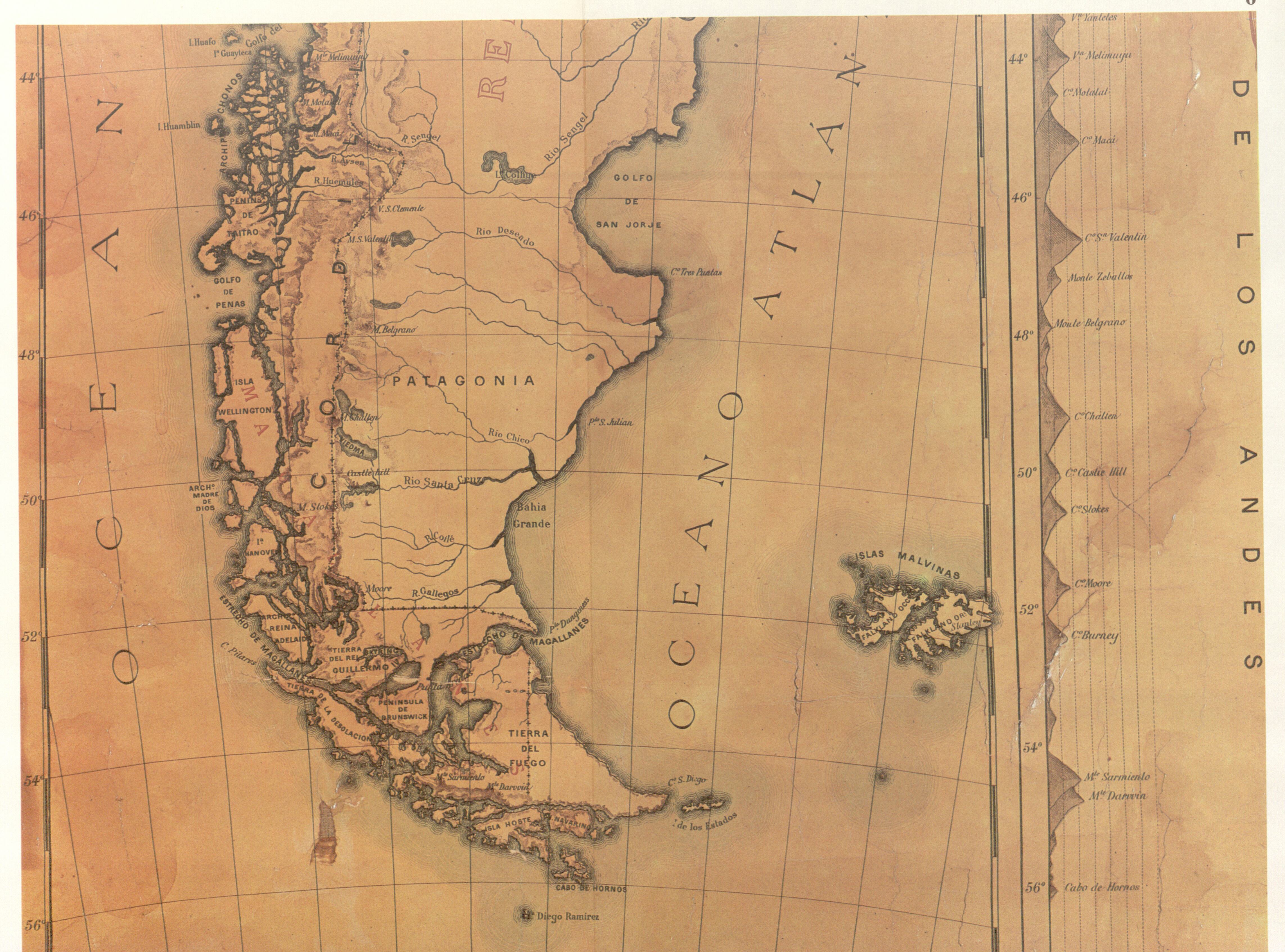
"This official map of Chile, partially reproduced here, 'was drawn up on the orders of the Chilean Government for use in primary schools in the Republic and with a view to the most recent data' by Alejandro Bertrand in 1884. The author, an engineer, was member of the Boundary Commissions charged with marking out the Chilean-Argentine Frontier. At the time the map was approved by the Chilean Hydrographic Office. On the map all the islands south of the Beagle Channel as far as Cape Horn are shown as being under Chilean sovereignty." |
||||
| Data | |||||
| Origem | El Conflicto del Beagle, edited by the chilean Foreign Affairs Office, 1978, Switzerland. | ||||
| Autor | Alejandro Bertrand | ||||
| Permissão (Reutilizar este ficheiro) |
|
||||
Histórico do ficheiro
Clique uma data e hora para ver o ficheiro tal como ele se encontrava nessa altura.
| Data e hora | Miniatura | Dimensões | Utilizador | Comentário | |
|---|---|---|---|---|---|
| atual | 15h12min de 18 de agosto de 2007 | | 4 570 × 3 386 (1,96 MB) | Keysanger | {{Information |Description="This official map of Chile, partially reproduced here, 'was drawn up on the orders of the Chilean Government for use in primary schools in the Republic and with a view to the most recent data' by Alejandro Bertrand. The author, |
Utilização local do ficheiro
A seguinte página usa este ficheiro:
Utilização global do ficheiro
As seguintes wikis usam este ficheiro:
- de.wikipedia.org
- en.wikipedia.org
- es.wikipedia.org
- fr.wikipedia.org