
Ficheiro:Bayou Teche and Atchafalaya River.jpg
Dimensões desta antevisão: 399 × 599 píxeis. Outras resoluções: 160 × 240 píxeis | 320 × 480 píxeis | 999 × 1 500 píxeis.
Imagem numa resolução maior (999 × 1 500 píxeis, tamanho: 213 kB, tipo MIME: image/jpeg)
|
|
Esta imagem provém do Wikimedia Commons, um acervo de conteúdo livre da Wikimedia Foundation que pode ser utilizado por outros projetos.
|
| Descrição |
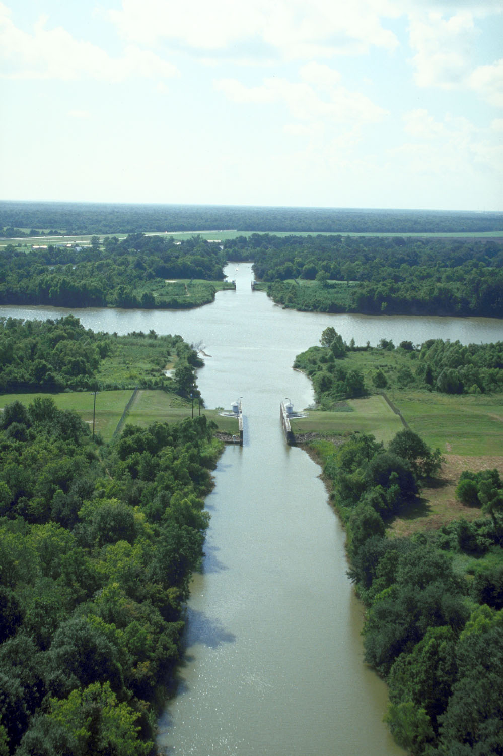
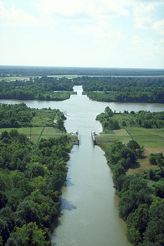
English: The intersection of Bayou Teche and the Wax Lake outlet of the Atachafalaya River near Patterson, Louisiana, USA. Bayou Teche runs straight up the center of the picture. The Wax Lake outlet of the Atchafalaya runs across left–right. The U.S. Army Corps of Engineers has built water control structures on the bayou where it intersects with the river. |
|||
| Data | ||||
| Origem |
U.S. Army Corps of Engineers Digital Visual Library Image page Image description page Digital Visual Library home page |
|||
| Autor | Michael Maples, U.S. Army Corps of Engineers | |||
| Permissão (Reutilizar este ficheiro) |
|
|||
| Local | St. Mary Parish, Louisiana, USA |
| Localização da câmara | | Esta e outras imagens nas suas localizações em: OpenStreetMap |
|---|
Histórico do ficheiro
Clique uma data e hora para ver o ficheiro tal como ele se encontrava nessa altura.
| Data e hora | Miniatura | Dimensões | Utilizador | Comentário | |
|---|---|---|---|---|---|
| atual | 19h57min de 7 de abril de 2007 | | 999 × 1 500 (213 kB) | DanMS | {{Information | Description = {{en|The intersection of Bayou Teche and the Wax Lake outlet of the Atachafalaya River near Patterson, Louisiana, USA. Bayou Teche runs straight up the center of the picture. The Wax Lake outlet of the Atchafalaya runs acr |
Utilização local do ficheiro
As seguintes 2 páginas usam este ficheiro:
Utilização global do ficheiro
As seguintes wikis usam este ficheiro:
- ca.wikipedia.org
- ceb.wikipedia.org
- de.wikipedia.org
- en.wikipedia.org
- es.wikipedia.org
- fa.wikipedia.org
- fr.wikipedia.org
- www.wikidata.org