
Ficheiro:Map of the Country of the Five Nations belonging to the province of New York and of the Lakes near which the Nations of Far Indians live with part of Canada taken from the Map of the Louisiane done 1730.png
Dimensões desta antevisão: 800 × 510 píxeis. Outras resoluções: 320 × 204 píxeis | 640 × 408 píxeis | 1 024 × 653 píxeis | 1 451 × 925 píxeis.
Imagem numa resolução maior (1 451 × 925 píxeis, tamanho: 1,52 MB, tipo MIME: image/png)
|
|
Esta imagem provém do Wikimedia Commons, um acervo de conteúdo livre da Wikimedia Foundation que pode ser utilizado por outros projetos.
|
Descrição do ficheiro
| Descrição |
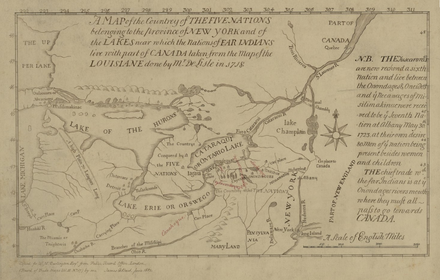
English: This is a map of the Five Nations that is part of the Darlington map collection housed in the Archives Service Center, University Library System, University of Pittsburgh, Pittsburgh Pittsburgh, PA US |
| Data | |
| Origem | The Darlington Collection |
| Autor | Desconhecido |
Licenciamento
|
Esta é uma reprodução fidedigna de uma obra de arte original bidimensional. A obra de arte está no domínio público pelas seguintes razões:
A posição oficial da Wikimedia Foundation é que «reproduções fiéis de obras de arte bidimensionais que estejam do domínio público estão também no domínio público e que reinvindicações em contrário constituem um ataque ao próprio conceito de um domínio público».
Para mais detalhes, consulte Commons:Quando usar a marcação PD-Art. Portanto, é considerado que esta reprodução fotográfica está também no domínio público. Saiba que, dependendo das leis locais, a reutilização deste conteúdo no seu país pode ser proibida ou estar sujeita a restrições. Consulte Commons:Reuse of PD-Art photographs. | ||||
Histórico do ficheiro
Clique uma data e hora para ver o ficheiro tal como ele se encontrava nessa altura.
| Data e hora | Miniatura | Dimensões | Utilizador | Comentário | |
|---|---|---|---|---|---|
| atual | 15h40min de 16 de junho de 2021 | | 1 451 × 925 (1,52 MB) | Psiĥedelisto | (Slightly) higher quality version from same source. |
| 12h26min de 29 de agosto de 2020 |  | 936 × 585 (705 kB) | User-duck | Cropped narrower using CropTool with precise mode. | |
| 22h17min de 12 de junho de 2017 |  | 980 × 593 (799 kB) | Barbara (WVS) | User created page with UploadWizard |
Utilização local do ficheiro
A seguinte página usa este ficheiro:
Utilização global do ficheiro
As seguintes wikis usam este ficheiro:
- azb.wikipedia.org
- en.wikipedia.org
- en.wikisource.org
- es.wikipedia.org
- fr.wikipedia.org
- ro.wikipedia.org
- vi.wikipedia.org
- www.wikidata.org