
Ficheiro:WaroftheSpanishSuccession.png
Dimensões desta antevisão: 800 × 370 píxeis. Outras resoluções: 320 × 148 píxeis | 640 × 296 píxeis | 1 357 × 628 píxeis.
Imagem numa resolução maior (1 357 × 628 píxeis, tamanho: 51 kB, tipo MIME: image/png)
|
|
Esta imagem provém do Wikimedia Commons, um acervo de conteúdo livre da Wikimedia Foundation que pode ser utilizado por outros projetos.
|
Descrição do ficheiro
| Descrição |
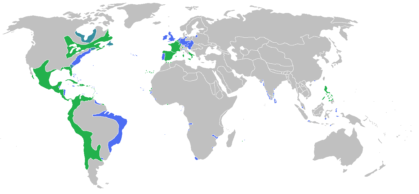
English: Locator map of the competing sides of the War of the Spanish Succession. Blue: Great Britain, Dutch Republic, Portugal with more. Green: Spain, France with more. |
| Data | |
| Origem | Obra do próprio |
| Autor | Gabagool |
Licenciamento
Eu, titular dos direitos de autor desta obra, publico-a com a seguinte licença:
A utilização deste ficheiro é regulada nos termos da licença Creative Commons - Atribuição 3.0 Não Adaptada.
- Pode:
- partilhar – copiar, distribuir e transmitir a obra
- recombinar – criar obras derivadas
- De acordo com as seguintes condições:
- atribuição – Tem de fazer a devida atribuição da autoria, fornecer uma hiperligação para a licença e indicar se foram feitas alterações. Pode fazê-lo de qualquer forma razoável, mas não de forma a sugerir que o licenciador o apoia ou subscreve o seu uso da obra.
Histórico do ficheiro
Clique uma data e hora para ver o ficheiro tal como ele se encontrava nessa altura.
| Data e hora | Miniatura | Dimensões | Utilizador | Comentário | |
|---|---|---|---|---|---|
| atual | 13h56min de 13 de maio de 2010 | | 1 357 × 628 (51 kB) | Kieran4 | Borders for Dutch East Indies corrected |
| 01h35min de 26 de março de 2010 |  | 1 357 × 628 (51 kB) | Gabagool | some further adjustments | |
| 04h29min de 20 de março de 2010 |  | 1 357 × 628 (51 kB) | Gabagool | some corrections (NA) after notice and help by User:Magicpiano | |
| 22h32min de 13 de junho de 2009 |  | 1 357 × 628 (44 kB) | Gabagool | {{Information |Description={{en|1=Locator map of the competing sides of the War of the Spanish Succession.<br> Blue: Great Britain, Dutch Republic, Portugal with more. Green: Spain, France with more.<br> (Partially based on ''Atlas of World History'' (200 |
Utilização local do ficheiro
A seguinte página usa este ficheiro:
Utilização global do ficheiro
As seguintes wikis usam este ficheiro:
- el.wikipedia.org
- en.wikipedia.org
- fa.wikipedia.org
- fr.wikipedia.org
- hy.wikipedia.org
- ko.wikipedia.org
- lt.wikipedia.org
- pl.wikipedia.org
- th.wikipedia.org
- uz.wikipedia.org
- vi.wikipedia.org