
Ficheiro:California US Congressional District 41 (since 2013).tif

Dimensões desta antevisão em PNG do ficheiro TIF: 800 × 396 píxeis Outras resoluções: 320 × 158 píxeis | 640 × 317 píxeis | 1 024 × 507 píxeis | 2 016 × 998 píxeis.
Imagem numa resolução maior (2 016 × 998 píxeis, tamanho: 3,29 MB, tipo MIME: image/tiff)
|
|
Esta imagem provém do Wikimedia Commons, um acervo de conteúdo livre da Wikimedia Foundation que pode ser utilizado por outros projetos.
|
Descrição do ficheiro
| Descrição |
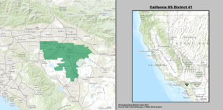
English: Boundaries for California's 41st US Federal Congressional District — in western Riverside County, California. |
| Data | |
| Origem | GIS shapefile data created by the United States Department of the Interior, as part of the "1 Million Scale" geospatial data project. Retrieved from: http://nationalatlas.gov/atlasftp-1m.html?openChapters=#chpbound |
| Autor | 1: GIS (congressional districts, 2013) shapefile data was created by the United States Department of the Interior. 2: Data was rendered using ArcGIS® software by Esri. 3: File developed for use on Wikipedia and elsewhere by 7partparadigm. |
Licenciamento
This map was obtained from an edition of the National Atlas of the United States. Like almost all works of the U.S. federal government, works from the National Atlas are in the public domain in the United States.
Online access: NationalAtlas.gov | 1970 print edition: Library of Congress, Perry-Castañeda Library
|
Histórico do ficheiro
Clique uma data e hora para ver o ficheiro tal como ele se encontrava nessa altura.
| Data e hora | Miniatura | Dimensões | Utilizador | Comentário | |
|---|---|---|---|---|---|
| atual | 03h36min de 22 de março de 2014 |  | 2 016 × 998 (3,29 MB) | 7partparadigm | User created page with UploadWizard |
Utilização local do ficheiro
A seguinte página usa este ficheiro:
Utilização global do ficheiro
As seguintes wikis usam este ficheiro:
- en.wikipedia.org
- fr.wikipedia.org
- hu.wikipedia.org
- tr.wikipedia.org
- www.wikidata.org
- zh.wikipedia.org